Extreme flooding could impact trade growth in East Africa without urgent investment in climate adaptation

A new tool developed by the universities of Oxford and Southampton reveals how future growth in trade might be affected by extreme climate impacts.
A regional climate resilience assessment warns that this must be taken into account when planning new infrastructure in East Africa.
The HVT research project ‘Decision Support Systems for Resilient Strategic Transport Networks’ has created the first detailed analysis of climate change driven flooding risks to long-distance roads and railways networks in Kenya, Tanzania, Uganda, and Zambia.
Preliminary research showed that key roads and railways are vulnerable to flooding, which may result in significant economic costs in the form of direct damages. Since then, additional research has found that economic costs in the form of indirect losses of trade may be even greater. The analysis also shows that there is a very compelling case for investing in climate adaptation with the benefit of avoiding climate risks far outweighing the investments needed.
Widespread failures and disruptions to transport networks can put long-term sustainable development, social wellbeing and economic stability at risk. In view of growing climate hazard threats, there is a need to create evidence of the impacts of current and future climatic risks to transport networks.
The regional climate resilience assessment of transport infrastructure developed by the University of Oxford for the East African case-study region seeks to understand the magnitudes and locations of exposures, damages, economic disruptions, and risks from climate related hazards to strategic road and railway network links.
Specifically, the project seeks to answer:
- Where are networks exposed to extreme natural hazards?
- What are the direct physical damages of assets exposed to these hazards?
- What are the losses and wider economic impacts of infrastructure failures?
- What are some quantifiable climate resilience adaptation options to reduce the vulnerability of infrastructure assets?
- Where and what are the key network locations prioritized for climate adaptations measures?
The project findings have been presented through a first-of-its-kind open and accessible decision-support tool, available here.
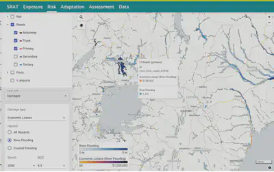
Figure 1: Screenshot of the systemic risk assessment tool, highlighting economic losses from river flooding of roads in East Africa.
A key takeaway from the assessment is that it demonstrates that there is a significant increase in flooding risks for strategic long-distance road and rail links across all case study countries. The analysis estimates that, due to climate change, cumulative direct damage risks for road and rail assets might grow from US$ 41 million/year in the current baseline to about US$ 82-131 million/year by 2080 across all climate scenarios.
Most of this increase would happen because extreme flooding events might start manifesting with increased frequency and severity in the future, and the road and railway assets designed for historical levels of flooding might not be able to withstand these extremes.
Further analysis also shows that indirect economic risks to import-export trade flows due to disruptions of key transport linkages might grow from US$ 0.16 million/day of disruption in the current baseline to about US$ 4.2 million/day by 2080 across all climate scenarios. These increased risks highlight how future growth in trade might be affected by extreme climate impacts and should be accounted for in new infrastructure investments being made in the region. Figure 2 shows a map of expected annual economic losses (EAEL) [1] per day of disruption from river flooding of roads under baseline conditions as compared to under future climate condition [2] RCP 8.5 in 2080.
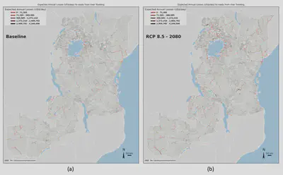
Figure 2: Map of expected annual economic losses (EAEL), in USD per day, from river flooding to roads under (a) baseline conditions and for 2080 under RCP 8.5.
The study also explores several adaptation options for strengthening resilience of road and rail links to flooding, specifically: swales, spillways, mobile flood embankments, floodwalls, drainage rehabilitation, and paving unpaved roads. The analysis shows that there is a very compelling case for investing in climate adaptation of several assets with the benefit of avoiding climate risks far outweighing the investments needed till 2080.
Figure 3 shows the adaption option with the maximum benefits in terms of risk reduction, maximum costs in terms of investment needed, and the subsequent benefit cost ratio. There are several assets where the benefit of avoiding climate risks far outweigh the investments needed. For example, investing in climate adaptation from the present till 2080 to strengthen resilience of the 20 most vulnerable roads and railway lines in the region would amount to about US$ 9 million and US$ 92 million in adaption costs but would avoid risks as high as US$ 875 million and US$ 234 million across future climate scenarios.
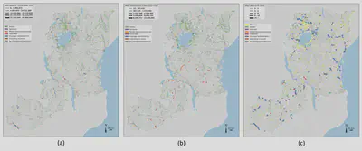
Figure 3: The effectiveness of adaptation options for river flooding of roads is evaluated through a cost-benefit analysis (CBA) comparing the (a) net present value (NPV) of maximum benefits due to avoided risks and the (b) NPV of maximum costs or investments needed over an implementation timeline, resulting in (c) a benefit-cost ratio (BCR) of optimal adaptation options.
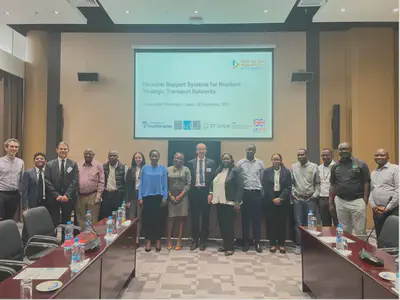
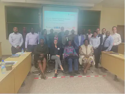
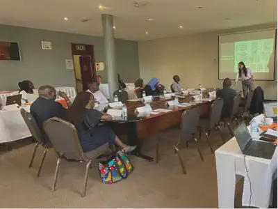
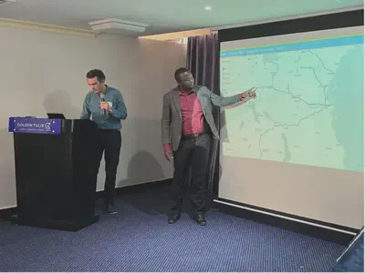
From September 17-26, 2022, the HVT team from Southampton University and Oxford University travelled to the case study countries to demonstrate this tool at workshops held in Lusaka, Dar es Salaam, Kampala, and Nairobi. Transport industry experts and practitioners from across the region gathered to discuss the tool and how it can better provide evidence and guidance to help decision-makers prioritise future investments in transport infrastructure and improve transport network resilience in East Africa.
Across all workshops, participants said that such systemic risk and resilience capabilities were very much needed in their countries, and that they wanted to be more engaged in familiarising themselves with underlying methodology, data and tools. There was also interest in tweaking the tool to the needs of stakeholders interested in using better data for their specific country needs.
Some examples of potential applications of the WP3 climate risks and resilience work that were suggested during the workshops include:
- Assessing flooding issues along border roads between Zambia and Mozambique which create bottlenecks for several days during the flood season
- Assessing flood risks for new railway routes such as the Tanzania SGR route towards Burundi
- Road expansion projects like the Busega-Mpingi expressway in Uganda or the Lasseru-Kitale and Morpus-Lokichar road upgrading project in Kenya
[1] Expected annual economic losses (EAEL) is a measure of the expense that would occur in any given year if the losses from all hazard probabilities and magnitudes were spread out equally over time. In other words, it is a measure of the average losses that could be incurred in any given year; it does not mean that each year will produce the same damages. EAEL is estimated as the area under the annual exceedance probability versus asset damage loss curve.
[2] The Representative Concentration Pathways (RCPs) provide a range of possible future for atmospheric conditions, as defined by the Intergovernmental Panel on Climate Change (IPCC). More information is provided in this infographic: https://coastadapt.com.au/infographics/what-are-rcps